From the middle of September, the weather forecasts had been scrutinised everyday to find good conditions for boating. A number of important items had to be delivered or picked up from the huts down island. Then all the weather systems lined up to produce a day that was perfect for boating.
The evening of the 19th saw a very bright full moon. This was accompanied by light wind conditions and a mostly clear sky.
 |
| Photo experiment on a full moon night, after 10pm. This 25 second time exposure shows a clear night with the landscape lit up by moonlight and hundreds of stars visible |
The beautiful, calm clear night was a prelude of the conditions for the next day.
A few days earlier I had been asked to be one of the crew on the boats. The day dawned as clear and calm as the night, so all involved were ready and eager to be on the water as early as possible.
 |
| This was taken as I made my way up to the boat shed. The conditions were near perfect - very little wind or swell and some mist about (you can see a faint 'fog bow') |
We had the three IRB's ready and in the water off Landing Beach by 10:20. Each boat had two crew and were loaded with as much cargo as could be carried. We headed south over glassy water and calm winds. Clive (doctor) and I were in boat 4546, Mark (Station Leader) and Josh (Plumber) in 5350 and Greg (Senior Comms Tech) and Tony (Chef) in 5280.
 |
| On board IRB 4546 with skipper Clive, waiting offshore from Landing Beach while the other boats are launched |
 |
| Offshore from the Nuggets |
 |
| Mt Elder - there is a radio repeater arial on top of the peak |
 |
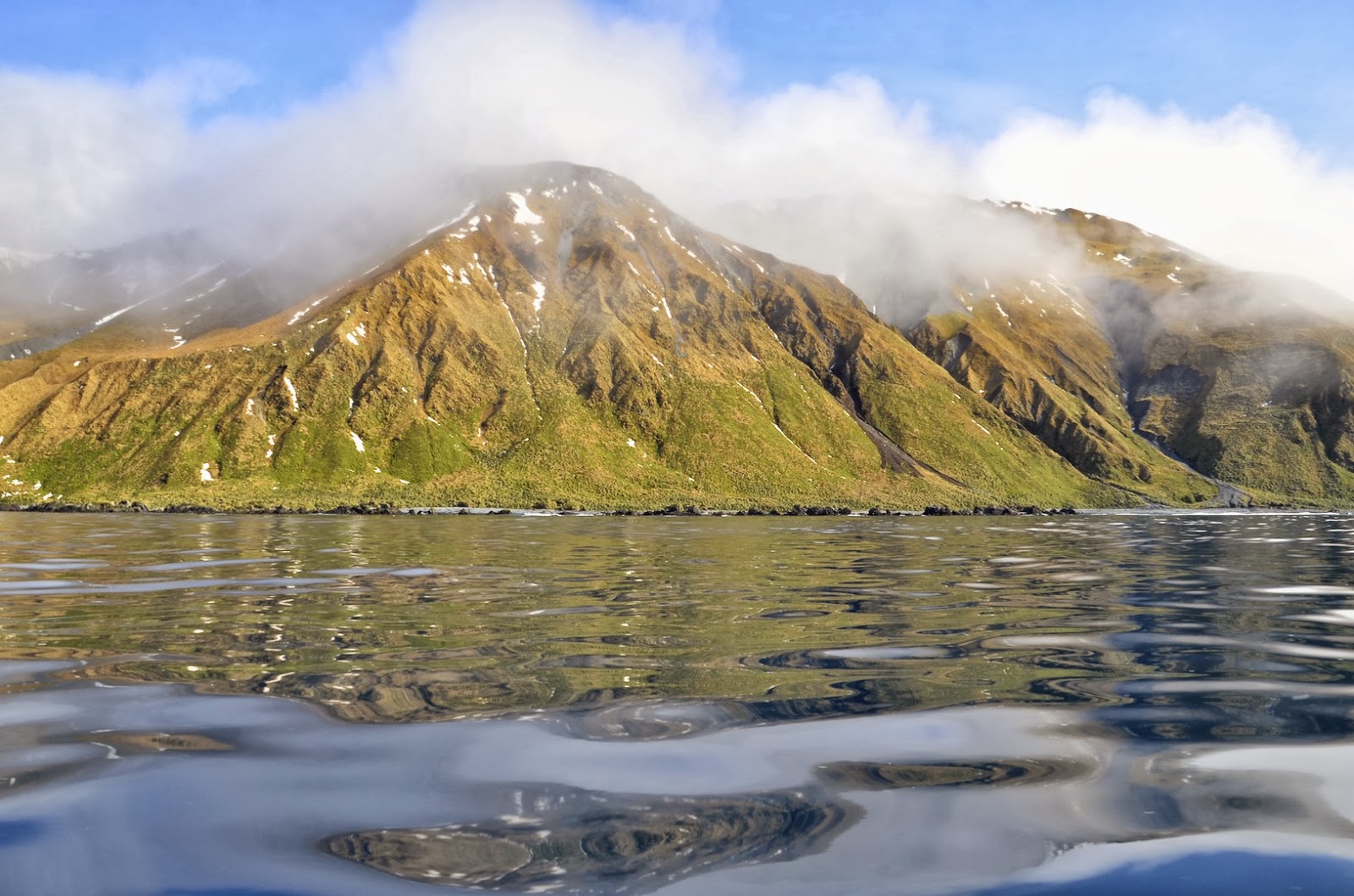
| Calm conditions as we make our way south - the peaks of Mt Elder (right) , Mt Power (middle) and Mt Blair (left) |
 |
| Looking east across a glassy Southern Ocean - Greg and Tony in 5280 and Mark and Josh further out in 5350 |
 |
| Perfect boating conditions |
Our first stop was landing on the beach at Sandy Bay just north of Brothers Point hut. Each boat was carrying a load of pre-sawn timber pieces for track work around the hut. After landing safely on the beach one person from each boat held it in position on the steep slopping beach while the other person unloaded. We deposited the timber amongst the tussock above the beach, beyond the high tide mark.
 |
| Sandy Bay beach landing, just north of Brothers Point hut (which you can see up the beach on a hill) |
After the timber was unloaded, Clive made his way up to the hut to change over supplies in the medical kit. Also Josh and I carried a wind generator as well as a small power (petrol) generator up to the hut, returning to the boats with 6 sleeping bags and the replaced power generator.
The walk to and from the hut was all the more difficult because we were wearing thick (heavy) neoprene dry suits as well wearing thermal underwear and two layers of fleece inside the suits. It was hot, heavy going across the loose sand then up the hill to the hut.
We were soon back on the water heading south for another 7 km.
 |
| Brothers Point hut |
 |
| Still perfect conditions |
 |
| Heading south towards a fog bow |
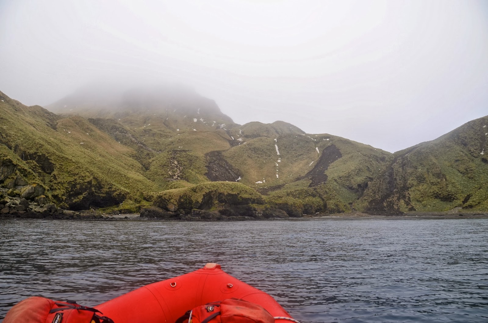
Our next landing was a very easy one at Green Gorge. It is a beautiful scenic approach to the beach at Green Gorge. It was made even more special by the abundant wildlife on the beach, mostly king penguins and a number of elephant seals.
 |
| The picturesque approach to Green Gorge |
 |
| As we got closer we could see the many penguins and seals on the beach |
After landing on the beach we unloaded the crates and boxes, boosting much needed supplies for the hut. There were also some items that were loaded back onto the boats for our next stop. These had been dropped off at Green Gorge on previous boating trips or were brought down island in back packs by expeditioners. After I had a few spare minutes to take photos of the wildlife. While we were there a elephant seal pup was born.
 |
| The king penguins on the beach near Green Gorge hut |
 |
| Green Gorge - A male elephant seal rests on the rocky beach as king penguins look on |
 |
| King penguins on the beach in front of the Green Gorge hut |
 |
| Picturesque Green Gorge beach |
 |
| Large male elephant seal oblivious to the boats on the beach at Green Gorge |
Soon we were back in the water heading further south, parallel to the amazingly scenic coast.
There was still some snow covering and it made the walk a little hazardous as it was unknown what was hiding under the snow. Our heavy dry suits did not help matters as both Tony and I stepped into deep wallows several times - a couple of times up to our thighs. After reaching the marker we walked along the track for around 500 metres, finally catching a glimpse of Waterfall Bay hut as we came over a small rise.
 |
| Elephant seal pup on the beach near the landing spot at Waterfall Bay |
 |
| Tony, dressed in his dry suit, leading the way across the tussock and wallow towards the track at the base of the slope |
 |
| Arriving at Waterfall Bay hut |
After dropping off our cargo at the hut, we were just about to head back to the boats when Mark and Greg turned up. Mark told us he had just stepped into a hole through the snow and was up to his armpits in the water. Lucky he had a dry suit on.
Mark then informed us that we had to carry bags of dried dog food back to the boats. There was a shortage of this food back at station. The four of us each carried two 8kg bags back to the boat. This was extremely awkward as it was hard to get a good grip on the bags. After some hard slog we finally arrived back at the boats with 64kg of dog food.
 |
| View just to the south of waterfall Bay hut |
 |
| Mark and Greg each carrying 2 bags of dog food back to the boats. Note the water hole to the left which is probably 1.5 metres (or more) deep |
 |
| King penguins near the Waterfall Bay landing site |
 |
| View to the south from the Waterfall Bay landing site |
After stowing the bags of dog food on the three boats, it was decided that as it was still early and great conditions, we would continue our journey south.
After travelling a further 3 km south we stopped the motors after rafting up in the calm and glassy conditions about 300 metres offshore from Lusitania Bay. We had a pleasant lunch out on the water.
 |
| Our lunch stop - around 300 metres offshore from Lusitania Bay |
After lunch we continued south, then finally rounded Hurd Point, the southern most part of Macquarie Island. Although there was a small southwest swell, the conditions were still great. These benign conditions for the southern and western coasts of the island are very rare.
We approached the beach near Hurd Point hut, which we could have easily landed on. There was no reason to land so we continued westward along the very rugged south coast, where we saw some incredible rock formations and sea cliffs.
 |
| Hurd Point - the southern most part of Macquarie Island |
 |
| Hurd Point hut at the base of the rugged steep slopes at the southern end of the island |
In the previous picture - it is a steep descent from the escarpment down the grassy slope to the left of the hut.
 |
| Having a closer look at Hurd Point hut |
 |
| The awesome rugged steep slopes of the southern end of Macquarie island - there is very little access around the coast |
 |
| Incredible rock arch about 200m offshore from the south coast |
We then proceeded around South West Point and travelled about 1km northwards up the west coast, then rounded Caroline Point and had a small eastward course into Caroline Cove. It was amazing how calm the seas were. We stopped offshore from the cove to replenish ourselves with a drink and snack.
 |
South West Point
|
 |
| Caroline Cove |
 |
| Looking north along the west coast out of Caroline Cove |
It was time to head back to base, so we retraced our route at a steady pace.
The water was still glassy as we travelled back up the east coast, though we did start to encounter some patchy drizzle.
 |
| Tracking north, parallel to the coast - The penguins are returning in large numbers to their breeding and moulting grounds |
Just south of Lusitania Bay we spotted an orca, so we slowed right down and kept a eye on the waters for the tell tale signs of the whale surfacing. All of a sudden it appeared out of the glassy water to take a breath. It appeared again three times before going to deep water.
All the while everyone in the boats were snapping pictures when the lone orca breached the surface. Greg had a waterproof camera which he put into the water, not knowing wether he got any footage.
He was amazed when he arrived back at station to find he had taken video of the orca under water.
 |
| Lone Orca |
 |
| Orca |
 |
| Underwater snapshot taken from Greg's video (Photo by Greg Bird) |
After the encounter with the orca we steadily made our way up the coast.
 |
| Offshore from the coast near Lusitania Bay - making our way back up the east coast |
 |
| We were all happy after our encounter with the orca |
 |
| Nearly home |
Despite wearing three layers clothes and a dry suit I was pretty cold when we arrived back at Landing Beach at around 1715. We had been almost 7 hours out on the water. We had covered around 85km in that time and saw many parts of the coast that had rarely been seen from the vantage point out in the water.
It had been a awesome day out in the boats, with the added bonus of seeing a orca.
Until next time when I will take you on a journey through Spring on Macquarie Island.....


No comments:
Post a Comment