 |
| Three Macquarie shags flying south - a few days before we set off in the same direction on our field training |
We have a dedicated field training officer (FTO) for the year - Marty. He provided us with much of the pre-departure training in survival, SAR and boating.
Before the MIPEP crew could go out in the field - they had to go through 5 days of field training. Now it was our turn.
I was in the last group, with Aaron and Tony (chef). We were to spend 3 days out in the field.
The night before, after dinner, we met in the library and Marty took us through the program we were to cover in the next 3 days. A essential first step - check the weather forecast.
Forecast for Wednesday
Cloudy with rain increasing during the morning, then easing to a few showers
during the afternoon before clearing for a period in the evening. Low cloud and
mist at times during the morning and early afternoon.
Winds: Northwesterly 25 to 35 knots, reaching 40 knots ahead of a west to
northwesterly change at 20 to 30 knots in the afternoon. Winds then tending
westerly 25 to 35 knots late.
Seas: Seas: 3 to 4 metres, abating for a period in the afternoon. Swell: Westerly 3 to 4 metres.
Outlook for Thursday
Cloudy with a few showers, increasing to rain during the morning then easing to
a few showers again in the evening.
Winds: Westerly 25 to 35 knots, tending northwesterly 30 to 40 knots during the
morning before shifting west to southwesterly at similar speeds in the late
afternoon and evening. Seas: 3 to 4 metres. Swell: Westerly building to 5 to 6
metres.
So as you can see it was going to be wet and windy for our first 2 days in the field. We also reviewed what we would need to take in our survival pack and what gear and clothes to wear.
Day 1
Up early, rechecked my survival pack, then met with Marty, Aaron, and Tony in the mess for a session on navigation and map and compass use. We then went to our rooms and dressed in our wet weather gear and then met at the porch of the mess at 1100.
After turning our fire tags and writing our intentions on the fire board we proceeded to the green store where we were taught how to adjust our packs, which were also weighed (all around 14kg). It was then off to the comms building, where we each picked up a radio, PIRB and GPS, with Aaron also piciking up a 'spot' tracker.
By noon we were on our way - first along the East Beach to Gadgets Gully.
 |
| At the bottom of Gadgets Gully ready to make the 'jump up' |
We made our way slowly up Gadgets Gully following the rocky bed of the creek. we were protected from the wind, though the rain was persistent. When we reached the top of the gully we were buffeted by the gale force westerly winds and visibility was down to a hundred metres as we were now in the cloud. We climbed steadily up the sloping track, which was mostly ankle deep in mud.
After reaching the junction of the Gadgets, Overland (OLT) and Island Lakes (ILT) tracks we stopped for a short break before proceeding along the ILT. The rain was driven horizontally, with our packs behaving like a sail. It took concentration to stay on our feet and try not to step into the deeper mud puddles. We stopped after an hour to have lunch, next to a small hill, at which we tried to find a position among the rocks to shelter from the wind.
 |
| Aaron, sheltering behind the rocks to have his lunch |
We finally had Emerald Lake on our left and knew that it was all downhill from here. We dropped out of the cloud and though it was still raining, we could see our destination down the gently sloping valley. We could also see the west coast and Bauer Bay.
 |
| Marty Tony and I making our way down the gentle slope towards Bauer Bay |
It was very comfortable in the hut and soon we had pasta cooking on the stove. While it was cooking Aaron carried out repairs on his torn outer pants - As we could not find a sewing kit, Aaron the ingenious one, fashioned a needle out of a piece of a steel guitar string and used dental floss for thread.
After the tasty pasta we prepared some custard with re-hydrated dried fruit.
We eventually settled for the night in cosy sleeping bags, while the gale force winds and rain persisted outside our nice warm cocoon.
 |
| The windswept, sandy creek bed at Bauer Bay - on the right of picture a rugged part of the coast can be seen known as Boiler Rocks |
 |
| Bauer Bay Hut at sunset |
 |
| The view from Bauer Bay hut looking east towards the plateau |
 |
| Aaron carrying out repairs on his pants using part of a guitar string and dental floss |
 |
| Tony (chef and Aaron inside the well appointed Bauer Bay hut |
Up early - put the kettle and heater on (have to isolate gas overnight - risk of carbon monoxide). After a nice hot breakfast of porridge, Marty took us through a session of map reading and navigation as well as planning the days walk. We cleaned the hut and packed ready to go. Put on our walking clothes (layers) which were still a little damp from the previous days walk.
 |
| Bauer Bay hut - seemed a little brighter, though it was still quite windy |
 |
| Inside Bauer Bay hut - morning lesson in map reading and navigation |
 |
| Aaron, Marty and Tony walking through the beautiful landscape |
 |
| The stunning scenery in the 'Labyrinth' on Mawson Point |
 |
| On the featherbed - Tony and Aaron dressed for the protection against the elements |
 |
| The featherbed on the west coast south of Bauer Bay |
 |
| The remnants of the Royal penguin summer breeding colony in Flat Creek |
We then trudged through the bog in the wide valley of Flat Creek. Occasionally one of us would be sink in a bog hole up to their knee/s. Luckily the wind was at our back because we were experiencing constant snow showers, sometimes turning into hail pellets. Slowly we travelled southeast until we came to an area where the creek split into several arms. We had to cross one of these smaller creeks, constantly sinking shin deep into the quagmire.
At one section I sunk into the bog up to my knees. With the heavy pack it was an effort to extract myself, then, only after a couple of steps, sink again up to my knees. The bog was like thick honey or treacle and quite hard to get out off. I had to remove my pack, then crawl on hands and knees to higher, less boggy ground, dragging my pack behind me (with a little help from the others).
After reaching higher ground, the going was a little easier.
We eventually ventured onto the Overland Track, and followed it south for around 500 metres to a small ridge. Here we were treated to a magnificent vista southward across the Red River valley and the distant peaks further south.
 |
| On the Overland Track looking south across Red River valley and the peaks of the southern part of the island |
 |
| On the Brothers Track looking southeast |
 |
| On the Brothers Track looking north |
 |
| Brothers Point hut - fibreglass 'googie' |
What a beautiful spot Brothers Point is - the hut overlooks Sandy Bay. What a bonus to have Tony with us. He made pizzas (from scratch) for dinner. A great end to a fabulous day, despite the weather and the tough terrain.
 |
| Brothers Point RAPS - self contained unit with wind generator , solar panel and backup generator with fuel supply |
 |
| Brothers Point hut - small water tank on the left and the narrow timber structure attached to the right side is a shower enclosure |
 |
| Stilbocarpa Polaris - Macquarie Island cabbage was used by the early explorers and sealers as a food source to prevent scurvy |
 |
| View form Brothers Point hut southward to Sandy Bay (can just see the Nuggets in the distance) |
Overnight the hut was shaken by the wind and constantly pelted by hail. Before breakfast we had a radio sched with VJM (station). The forecast was read out and then the occupants of each hut around the island gave their intentions for the day. Ours was to walk from Brothers Point back to station via the East coast.
After a breakfast Marty went through all the items that are available in the huts extensive medical kit (same kit at each hut). We then cleaned up and were on our way just after 10am.
The first part of our walk (100m) was quite hazardous as we negotiated the deep muddy track down to the beach. Then it was a pleasant stroll along the long sweeping beach of Sandy Bay.
 |
| Just before leaving Brothers Point hut |
 |
| A pleasant stroll along the beach at Sandy Bay - Brothers Point hut in the distance |
 |
| King penguins at the northern end of Sandy Bay |
 |
| What remains of the huge Royal penguin colony up the slope at the northern end of Sandy Bay. In summer this colony is packed with many thousands of penguins |
 |
| Some of the Royal penguins marching through a group of King penguins at Sandy Bay |
 |
| Sandy Bay - a King penguin that has just come out of the water |
 |
| Large King penguin colony just north of Sandy Bay |
 |
| Historic hut amongst the King penguins |
 |
| Large gathering of King penguins |
 |
| King penguin colony just north of Sandy Bay |
Once past the King penguin colony we continued north. This part of the walk took us across numerous small coves and beaches separated by tussock covered rocky points. We stopped for lunch just north of the location of the shipwreck of the Jessie Niccol, which was wrecked nearby in 1910. We then continued on to the Nuggets. On the way we encountered many young elephant seals on the beaches and the smaller though more vocal fur seals who preferred to be amongst the rocks and tussocks.
 |
| Scrambling along the rugged East coast |
 |
| Crossing one of the many tussock covered points between Sandy Bay and Nuggets Point |
 |
| Tony, Aaron and Marty heading north along the beach towards Nuggets Point |
 |
| A different view of the Nuggets |
 |
| The rusty remains of the digesters at Nuggets Point - left over form the penguin harvest industry in the late 19th and early 20th Century |
 |
| The graves of Charles Anderson and Otto Bauer at Nuggets Point |
 |
| Royal penguins marching in single file down to the water |
 |
| Royal penguins on the beach at Nuggets Point |
 |
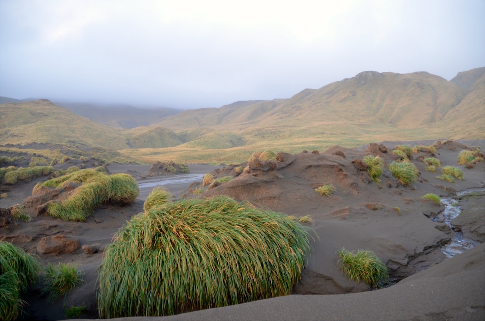
| Can you see the penguins high up the creek gully? |
To continue north we had to safely cross Nuggets Point. To do this we had to travel up through the tussock alongside Nuggets Creek and then cross the ridge down to the beach north of the point.
 |
| On top of the ridge of Nuggets Point - looking north towards North Head and the station in the distance |
 |
| A spectacular rock stack on the beach north of Nuggets Point |
 |
| Elephant seals hanging out on the beach |
Once past the rugged, rocky bit of coast near Halfway Hill it was a pleasant stroll along the final stretch of East Beach back to station.
 |
| One last navigation and map reading exercise |
We arrived back at station just before 5pm so had time for a hot shower and dress into some dry warm clothes, before heading off to a lovely dinner prepared by Tony H (in chefs absence).
Despite the wet, windy and cold weather, wet boots and aching muscles, I felt so lucky that I was able to go on such an awesome field trip.
Thanks to Marty, it was great to finally get off station and down island.
In the end we covered nearly 30 kilometres rough, undulating, muddy terrain.
Until Next Time....
Hi Baz
ReplyDeletethanks for the update and the great images
Cheers
Paul FH
Nice post Barry, what a beautiful place. Just to prove I read it, last caption for day2 I think you mean northward! :)
ReplyDeleteNice work Aaron with the repairs, funny because I fixed my trousers last night and I need to change a guitar string too.
cheers, Nick