From the last post (
Boating Induction - Part 1) we had just dropped off Chris, Josh and Dave at the beach just north of Brothers Point hut. As the weather and conditions were still ideal for boating, the plan was to travel northward back towards VJM.
Instead of taking the most direct route, it was decided to explore and practice manoeuvres inshore. We made our way slowly through the inshore kelp beds and rock stacks. It was an interesting perspective of the coast we walked along on day 3 of our
field training.
 |
| A different perspective of the king penguin colony at the northern end of Sandy Bay |
 |
| Giant Petrel |
 |
| Another view of the king penguins north of Sandy Bay |
Macquarie Island is unique in its formation. Unlike other sub-Antarctic islands -
it is the elongated and exposed tip of a chunk of oceanic crust that has been 'simply squeezed toward the surface like toothpaste from a tube.' (R A Kerr,
Science, 1993)
The rocks of the island have only have been exposed above the surface of the sea for 700,000 years which is only the blink of an eye in geological time.
From the boats the rugged and jagged peaks and slopes of this young island are revealed.
 |
| The 'raw' rugged peaks and slopes of Macquarie Island are visible along its entire coastline |
 |
| The rugged exposed rock slopes can be seen along the coast |
 |
| The clear waters between the kelp covered rocky outcrops |
 |
| The clear water provides a vivid colour contrast to the green colour of the vegetation covering the slopes beneath the 'young' jagged peaks |
As we travelled north we saw more of the amazing wildlife, some of which is endemic to Macquarie Island.
 |
| Macquarie Island cormorant (shag) |
We slowly made our way north, reaching the distinctive rock stacks known as the Nuggets. From the boats we were able to view this spectacular natural feature form a different angle. The Nuggets are visible from the station and provide an obvious landmark. From my perspective of weather observations - the Nuggets are a visibility marker being 3.9 km (south) from the weather station.
 |
| Heading north towards Nuggets Point and the Nuggets |
 |
| From station we only see two of the three Nuggets |
 |
| It is only when you are close that you realise the how beautiful and amazing they are |
 |
| The very distinctive vegetation and geological features of the Nuggets - especially the 'skirt' of kelp |
 |
| Side view - obvious delineation of flora. Also note several cormorants on the 'shelf' and the vivid colour of the water |
 |
| This is the view of two of the Nuggets with one hidden in the lee |
After the Nuggets we headed north towards Landing Beach. It was decided that, as the weather was still ideal for boating, we would continue the boating induction and head north a short distance around North Head.
 |
| After the Nuggets we headed north towards Landing Beach |
 |
| Heading north |
The only access to North Head is via the Wireless Hill track which starts at the station near Cumpston's Cottage. Only 1.5 km long it is a steep ridge at the very north of the island separated from the rest of the island by a short narrow isthmus (mostly just above sea level). Part of the northern section of North Head has restricted access all year with most of the rest having restricted access between the 16th of November and the 30th of September.
So the boat trip around this amazing part of Macquarie Island was a great opportunity.
 |
| North Head - the view from the boats shows how steep and rugged the coast is |
 |
| Negotiating the narrow channel between North Head and the large rock stack of Tern Rock |
 |
| The view south from aside North Head - Tern Rock on the left and the Nuggets can be seen in the distance on the far left |
 |
| There are many kelp covered rock stacks close inshore to North Head |
 |
| The steep and massive Tottan Head about 2/3rds of the way up the east side of North Head |
 |
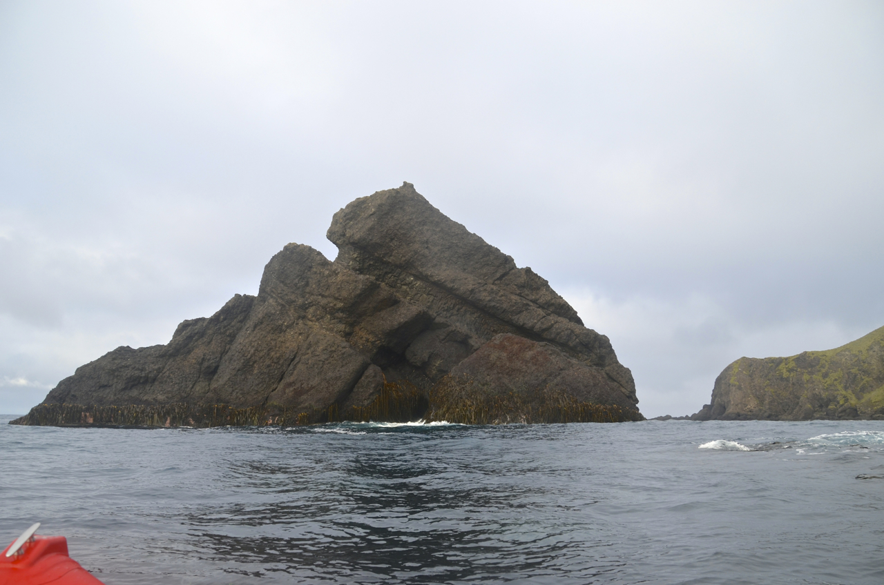
| Gorilla Head Rock just off the eastern tip of North Head |
We travelled just around North Head where we experienced a small westerly swell. It also gave us a unique view down towards the western side of the island.
 |
| Just off North Head - Gorilla Head Rock on the left and Tottan Head further south on the right |
 |
| View form just north of North Head with a glimpse of the western side of the island on the right |
 |
| From just north of North Head - Looking west towards the distant Handspike Point |
We then retraced our route back down the eastern side of North Head, this time getting a closer look at a big rock stack near the northern tip, populated by roosting cormorants. I also had a glimpse of a Rockhopper penguin colony perched at the base of a steep gully.
 |
| Large rock stack just north of North Head - home to a colony of cormorants |
 |
| Cormorants on top of the rock stack |
 |
| A small Rockhopper penguin colony tucked in at the base of a steep gully |
On the way back down the eastern side of North Head to Landing Beach, we had a closer look at Gorilla Head Rock.
 |
| Approaching Gorilla Head Rock |
 |
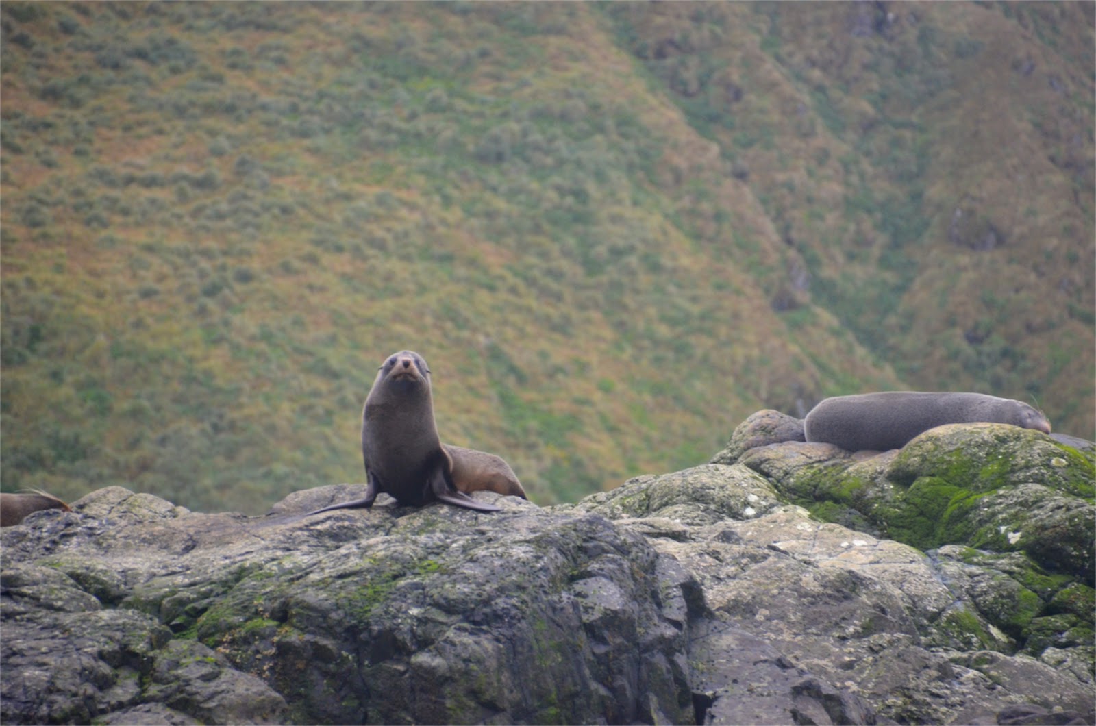
| Several fur seals on the rocks below the steep slopes of North Head |
 |
| This gives an idea of the size of Gorilla Head Rock |
 |
| North Head - the steep cliffs just above Secluded Beach |
 |
| Heading back |
 |
| View of the East coast through the channel near Tern Rock |
The end to a fabulous day on the water. Hopefully we will have another opportunity to go boating in the near future.
Only 3 weeks to go tip mid-winters day.


No comments:
Post a Comment